English
 Español
 Deutsch
 日本語
日本語 Polska
 Français
 中國
中國 한국의
한국의 Українська
 Italiano
 Nederlands
 Türkçe
 Português
 Bahasa Indonesia
 Русский
 हिंदी
हिंदीNorth Carolina Topographic Map STL Model 3D Принт Модель


- Доступные форматы: Stereolithography: stl 446.39 MB
- Коллекция:No
- Ширина в миллиметрах:395
- Высота в миллиметрах:2.5
- Глубина в миллиметрах:149
- Для печати:
- 3D Скан:No
- Контент для взрослых:No
- PBR:No
- AI Обучение:No
- Просмотры:1530
- Дата: 2022-06-17
- ID Продукта:402333
- Рейтинг:
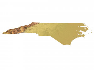
Create Detailed North Carolina Terrain Models with This High-Resolution 3D STL
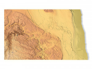
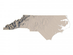
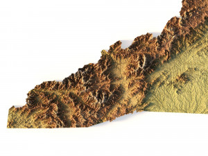
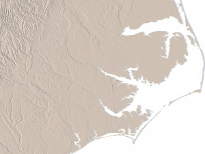
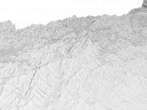
The North Carolina Topographic Map STL model provides a high-resolution depiction of the state’s diverse topography and geographic features. This 3D model is perfect for creating physical relief maps from wood, metal, plastic, or concrete. Whether for landform visualization, educational projects, or professional GIS applications, this model offers accurate elevation data for precise terrain modeling. Ideal for 3D printing, CNC machining, and laser engraving.
- File size: 822 MB / 589 MB
- Model size: 394.5 mm x 149.04 mm x 2.547 mm
- Resolution: 0,06 mm
- Projection: Mercator
- Scaling factor: X — 1; Y — 1; Z — 3
- Polygons: 17 242 718
- Vertices: 8 652 719
- Geometry: Polygonal Tris only
- Base: Open / Closed
Features of the North Carolina Topographic STL Model
Precise elevation data capturing North Carolina’s mountains, coastal plains, and piedmont regions.
Compatible with FDM/SLA 3D printers for high-quality terrain models.
Designed for CNC machining to craft detailed relief maps from wood or metal.
Supports high-precision laser engraving for metal surface detailing.
Если вам необходим другой формат, пожалуйста, сделайте запрос при помощи тикета поддержки. Мы можем cконвертировать 3D модели в такие форматы: .stl, .c4d, .obj, .fbx, .ma/.mb, .3ds, .3dm, .dxf/.dwg, .max. .blend, .skp, .glb. Мы не конвертируем 3d сцены и такие форматы, как .step, .iges, .stp, .sldprt и т. д.!