
 English
 Español
 Deutsch
 日本語
日本語 Polska
 Français
 中國
中國 한국의
한국의 Українська
 Italiano
 Nederlands
 Türkçe
 Português
 Bahasa Indonesia
 Русский
 हिंदी
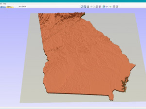
हिंदीTopographic Map of Georgia USA STL Model 3D Принт Модель


- Доступные форматы: Stereolithography: stl 484.55 MB
- Коллекция:No
- Ширина в миллиметрах:212
- Высота в миллиметрах:1.9
- Глубина в миллиметрах:244
- Для печати:No
- 3D Скан:No
- Контент для взрослых:No
- PBR:No
- AI Обучение:No
- Просмотры:1618
- Дата: 2022-06-17
- ID Продукта:402264
- Рейтинг:
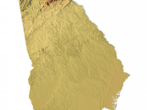
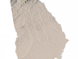
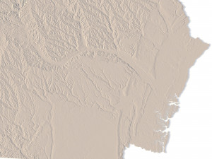
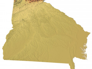
Create Detailed Georgia Terrain Models with This 3D STL File
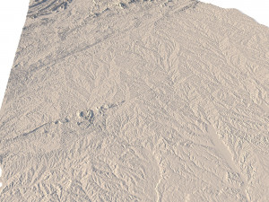
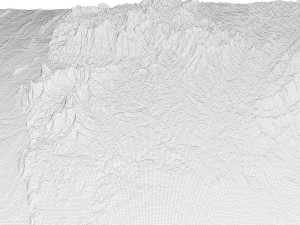
The Topographic Map of Georgia USA STL model offers a highly detailed 3D terrain representation of the state’s diverse landscapes. Perfect for crafting relief maps from materials such as wood, metal, plastic, or concrete, this model is ideal for landform visualization and professional projects in cartography or geospatial data analysis. With precise contour lines and accurate elevation models, it’s suitable for both educational and professional use.
- File size: 911 MB / 454 MB
- Model size: 212.04 mm x 244.44 mm x 1.851 mm
- Resolution: 0,06 mm
- Projection: Mercator
- Scaling factor: X — 1; Y — 1; Z — 3
- Polygons: 19 115 160
- Vertices: 9 574 200
- Geometry: Polygonal Tris only
- Base: Open / Closed
Features of the Georgia Topographic STL Model
Compatible with FDM/SLA 3D printers for physical model creation.
Supports CNC machining for wood or metal topographic models.
Ideal for high-precision laser engraving on metal surfaces.
Если вам необходим другой формат, пожалуйста, сделайте запрос при помощи тикета поддержки. Мы можем cконвертировать 3D модели в такие форматы: .stl, .c4d, .obj, .fbx, .ma/.mb, .3ds, .3dm, .dxf/.dwg, .max. .blend, .skp, .glb. Мы не конвертируем 3d сцены и такие форматы, как .step, .iges, .stp, .sldprt и т. д.!


